Pict. [Mapporn] Ireland’s ‘oldest known separate map’ (First map to show Ireland not just part of British Isles) expected to fetch €3 (#Part #Show #Map #Oldest #Fetch #Separate #Isles)Pict. 620×330 px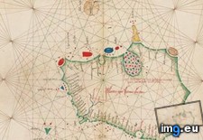 Pict. [Mapporn] Palaeontological and geological map of the British Isles, made 1854 by E. Forbes and A. Johnston [2377x3686] (#Map #British #Johnston #Forbes #Palaeontological)Pict. 2377×3686 px
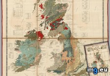 Pict. [Mapporn] The size of Japan compared to the British Isles [600x600] (#Japan #British #Size #Compared #600x600 #Isles)Pict. 594×594 px
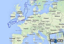 Pict. [Mapporn] The British & Irish Isles — minus Britain & Ireland [OC-ish] [887 x 1371] (#British #Ireland #Irish #Britain #Ish #Isles)Pict. 887×1371 px
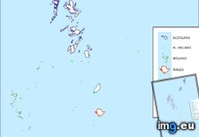 Pict. [Mapporn] The Doggerland region around the British Isles, 18,000 years ago when the sea levels were lower [1962x2005] (#Years #Ago #Region #Levels #Isles)Pict. 1962×2005 px
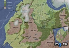 Pict. [Mapporn] British Isles basic history [720x540] (#British #History #720x540 #Basic #Isles)Pict. 720×540 px
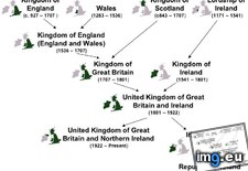 Pict. [Mapporn] Size Comparison Between Borneo and the British Isles [950x1180] (#British #Size #Comparison #Borneo #Isles)Pict. 950×1180 px
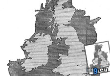 Pict. [Mapporn] Debossed map of the British Isles, from William Moon's Light for the Blind, 1877. [1210x2307] (#Map #Light #British #Moon #Blind #Isles)Pict. 1210×2307 px
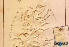 Pict. [Mapporn] Unification of the British Isles since 800 A.D. [900x620] (#British #Unification #Isles)Pict. 1619×1111 px
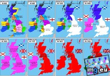
★ 6921 pts. ♥ 0 likes ⬇ 4 saves
Pict. [Mapporn] Palaeontological and geological map of the British Isles, made 1854 by E. Forbes and A. Johnston [2377x3686] (#Map #British #Johnston #Forbes #Palaeontological)Pict. 2377×3686 px★ 6733 pts. ♥ 0 likes ⬇ 7 saves
Pict. [Mapporn] The size of Japan compared to the British Isles [600x600] (#Japan #British #Size #Compared #600x600 #Isles)Pict. 594×594 px★ 5739 pts. ♥ 0 likes ⬇ 5 saves
Pict. [Mapporn] The British & Irish Isles — minus Britain & Ireland [OC-ish] [887 x 1371] (#British #Ireland #Irish #Britain #Ish #Isles)Pict. 887×1371 px★ 5664 pts. ♥ 0 likes ⬇ 12 saves
Pict. [Mapporn] The Doggerland region around the British Isles, 18,000 years ago when the sea levels were lower [1962x2005] (#Years #Ago #Region #Levels #Isles)Pict. 1962×2005 px★ 5630 pts. ♥ 0 likes ⬇ 14 saves
Pict. [Mapporn] British Isles basic history [720x540] (#British #History #720x540 #Basic #Isles)Pict. 720×540 px★ 5529 pts. ♥ 0 likes ⬇ 4 saves
Pict. [Mapporn] Size Comparison Between Borneo and the British Isles [950x1180] (#British #Size #Comparison #Borneo #Isles)Pict. 950×1180 px★ 5496 pts. ♥ 0 likes ⬇ 12 saves
Pict. [Mapporn] Debossed map of the British Isles, from William Moon's Light for the Blind, 1877. [1210x2307] (#Map #Light #British #Moon #Blind #Isles)Pict. 1210×2307 px★ 5212 pts. ♥ 0 likes ⬇ 4 saves
Pict. [Mapporn] Unification of the British Isles since 800 A.D. [900x620] (#British #Unification #Isles)Pict. 1619×1111 px★ 5018 pts. ♥ 0 likes ⬇ 6 saves