Pict. [Earthporn] Walking through a burn forest in the cascades. Pacific Crest Trail, Oregon. [3264x1836] (#Forest #Oregon #Walking #3264x1836 #Cascades #Crest)Pict. 3264×1836 px![[Earthporn] Walking through a burn forest in the cascades. Pacific Crest Trail, Oregon. [3264x1836] (#Forest #Oregon #Walking #3264x1836 #Cascades #Crest) - 463 KB Tags: 3264x1836, burn, cascades, crest, forest, oregon, pacific, trail, walking (Pict. in My r/EARTHPORN favs)](https://t.im9.eu/earthporn-walking-through-a-burn-forest-in-the-cascades-pacific-crest-trail-oregon-3264x1836.jpg) Pict. San Francisco, California. Panama-Pacific International Exposition (demolished) - night view of the Tower of the Ages (1915).145 (#Night #California #San #Tower #Demolished #Exposition #Ages)Pict. 799×791 px
Pict. San Francisco, California. Panama-Pacific International Exposition (demolished) - night view of the Tower of the Ages (1915).145 (#Night #California #San #Tower #Demolished #Exposition #Ages)Pict. 799×791 px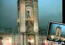 Pict. [Dataisbeautiful] Precipitation by county and state in (mm). The pacific NW isn't as rainy as an aggregate. [OC] (#State #County #Rainy #Precipitation #Aggregate)Pict. 1613×852 px
![[Dataisbeautiful] Precipitation by county and state in (mm). The pacific NW isn't as rainy as an aggregate. [OC] (#State #County #Rainy #Precipitation #Aggregate) - 124 KB Tags: aggregate, county, isn, pacific, precipitation, rainy, state (Pict. in My r/DATAISBEAUTIFUL favs)](https://t.im9.eu/dataisbeautiful-precipitation-by-county-and-state-in-mm-the-pacific-nw-isn-t-as-rainy-as-an-aggregate-oc.jpg) Pict. San Francisco, California. Panama-Pacific International Exposition Palace of Fine Arts, night view of rotunda (1915).1476 (#Night #California #San #Palace #Panama #Exposition #Arts #Rotunda)Pict. 799×956 px
Pict. San Francisco, California. Panama-Pacific International Exposition Palace of Fine Arts, night view of rotunda (1915).1476 (#Night #California #San #Palace #Panama #Exposition #Arts #Rotunda)Pict. 799×956 px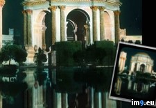 Pict. Driftwood, Pacific Rim National Park Reserve, Vancouver Island, British Columbia (#Park #National #Island #Vancouver #Rim #Reserve #Driftwood)Pict. 1600×1200 px
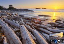 Pict. [Earthporn] The great pacific northwest [1024X579] (#Great #Pacific #Northwest #1024x579)Pict. 1024×579 px
![[Earthporn] The great pacific northwest [1024X579] (#Great #Pacific #Northwest #1024x579) - 93 KB Tags: 1024x579, great, northwest, pacific (Pict. in My r/EARTHPORN favs)](https://t.im9.eu/earthporn-the-great-pacific-northwest-1024x579.jpg) Pict. San Francisco, California. Panama-Pacific International Exposition (demolished) - night view from the Column of Progress toward (#Night #California #San #Panama #Demolished #Exposition #Progress)Pict. 799×723 px
Pict. San Francisco, California. Panama-Pacific International Exposition (demolished) - night view from the Column of Progress toward (#Night #California #San #Panama #Demolished #Exposition #Progress)Pict. 799×723 px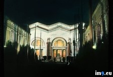 Pict. [Earthporn] Pacific Northwest view from Astoria, OR. [3264x2448][OC] (#Pacific #Northwest #Astoria)Pict. 3264×2448 px
![[Earthporn] Pacific Northwest view from Astoria, OR. [3264x2448][OC] (#Pacific #Northwest #Astoria) - 421 KB Tags: astoria, northwest, pacific (Pict. in My r/EARTHPORN favs)](https://t.im9.eu/earthporn-pacific-northwest-view-from-astoria-or-3264x2448-oc.jpg) Pict. Monterey County, California. 17-Mile Drive, a scenic route from Carmel to Pacific Grove - large tree (1920-1940).1374 (#California #Large #Tree #County #Route #Scenic #Monterey #Carmel)Pict. 799×752 px
Pict. Monterey County, California. 17-Mile Drive, a scenic route from Carmel to Pacific Grove - large tree (1920-1940).1374 (#California #Large #Tree #County #Route #Scenic #Monterey #Carmel)Pict. 799×752 px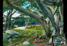 Pict. San Francisco, California. Panama-Pacific International Exposition (demolished) - Horticulture Building, dome detail (1915).1474 (#California #San #Building #Detail #Demolished #Exposition #Dome #Horticulture)Pict. 799×996 px
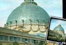 Pict. [Earthporn] Thor's Well, The Pacific Gateway To The Underworld. Lincoln County, Oregon (1000x682) (#County #Oregon #Pacific #Gateway #1000x682)Pict. 1000×682 px
![[Earthporn] Thor's Well, The Pacific Gateway To The Underworld. Lincoln County, Oregon (1000x682) (#County #Oregon #Pacific #Gateway #1000x682) - 94 KB Tags: 1000x682, county, gateway, lincoln, oregon, pacific, thor, underworld (Pict. in My r/EARTHPORN favs)](https://t.im9.eu/earthporn-thor-s-well-the-pacific-gateway-to-the-underworld-lincoln-county-oregon-1000x682.jpg) Pict. [Mapporn] Eurasia in the Pacific Ocean [1056x842] (#Ocean #Pacific #Eurasia)Pict. 1056×842 px
Pict. [Mapporn] Eurasia in the Pacific Ocean [1056x842] (#Ocean #Pacific #Eurasia)Pict. 1056×842 px![[Mapporn] Eurasia in the Pacific Ocean [1056x842] (#Ocean #Pacific #Eurasia) - 136 KB Tags: eurasia, ocean, pacific (Pict. in My r/MAPS favs)](https://t.im9.eu/mapporn-eurasia-in-the-pacific-ocean-1056x842.jpg) Pict. San Francisco, California. Panama-Pacific International Exposition (demolished) - Cuba Pavilion (by Francisco Centurion) and Por (#California #San #Pacific #International #Cuba #Pavilion #Por #Centurion)Pict. 799×625 px
Pict. San Francisco, California. Panama-Pacific International Exposition (demolished) - Cuba Pavilion (by Francisco Centurion) and Por (#California #San #Pacific #International #Cuba #Pavilion #Por #Centurion)Pict. 799×625 px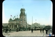 Pict. Tv Show The Pacific 223727 (#Show #Pacific )Pict. 1920×1200 px
 Pict. San Francisco, California. Panama-Pacific International Exposition (demolished) - Horticulture Building, interior view (1915).14 (#California #San #Interior #Building #Demolished #Exposition #Horticulture)Pict. 799×758 px
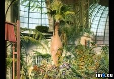 Pict. [Earthporn] Pacific coast at Jenner, Sonoma County, CA. [1600x1280] (#County #Coast #Pacific #Sonoma)Pict. 1600×1280 px
![[Earthporn] Pacific coast at Jenner, Sonoma County, CA. [1600x1280] (#County #Coast #Pacific #Sonoma) - 317 KB Tags: coast, county, pacific, sonoma (Pict. in My r/EARTHPORN favs)](https://t.im9.eu/earthporn-pacific-coast-at-jenner-sonoma-county-ca-1600x1280.jpg) Pict. Swiftsure Race in the Pacific Ocean, Victoria, British Columbia (#Victoria #British #Columbia #Race #Swiftsure)Pict. 1600×1200 px
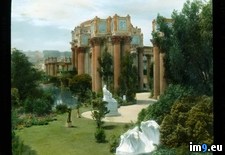
Pict. Swiftsure Race in the Pacific Ocean, Victoria, British Columbia (#Victoria #British #Columbia #Race #Swiftsure)Pict. 1600×1200 px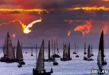 Pict. San Francisco, California. Panama-Pacific International Exposition Palace of Fine Arts, partial view of colonnade, garden (1915 (#California #San #Garden #Palace #Panama #Exposition #Partial #Arts #Colonnade)Pict. 799×743 px
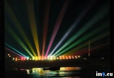
 Pict. San Francisco, California. Panama-Pacific International Exposition (demolished) - night view of General Electric's scintillator (#Night #California #San #General #Demolished #Exposition #Electric #Scintillator)Pict. 799×772 px
 Pict. [Mapporn] Map of the area of the 3 largest Pacific Island cultures. [800x520] (#Map #Island #Largest #Cultures #800x520)Pict. 872×567 px
![[Mapporn] Map of the area of the 3 largest Pacific Island cultures. [800x520] (#Map #Island #Largest #Cultures #800x520) - 56 KB Tags: 800x520, area, cultures, island, largest, map, pacific (Pict. in My r/MAPS favs)](https://t.im9.eu/mapporn-map-of-the-area-of-the-3-largest-pacific-island-cultures-800x520.jpg) Pict. San Francisco, California. Panama-Pacific International Exposition (demolished) - night view of General Electric's scintillator (#Night #California #San #General #Demolished #Exposition #Electric #Scintillator)Pict. 799×750 px
Pict. San Francisco, California. Panama-Pacific International Exposition (demolished) - night view of General Electric's scintillator (#Night #California #San #General #Demolished #Exposition #Electric #Scintillator)Pict. 799×750 px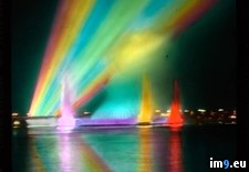 Pict. [Earthporn] Pacific Coast (PCH)- California [4752x3168] (#California #Coast #Pacific #4752x3168)Pict. 4752×3168 px
![[Earthporn] Pacific Coast (PCH)- California [4752x3168] (#California #Coast #Pacific #4752x3168) - 906 KB Tags: 4752x3168, california, coast, pacific (Pict. in My r/EARTHPORN favs)](https://t.im9.eu/earthporn-pacific-coast-pch-california-4752x3168.jpg) Pict. [Earthporn] Easy to see why this place is known as the 'Grand Canyon of the Pacific'. Waimea Canyon, Kauai, HI [5472x3648] (#Canyon #Place #Grand #5472x3648 #Waimea)Pict. 3283×2188 px
Pict. [Earthporn] Easy to see why this place is known as the 'Grand Canyon of the Pacific'. Waimea Canyon, Kauai, HI [5472x3648] (#Canyon #Place #Grand #5472x3648 #Waimea)Pict. 3283×2188 px![[Earthporn] Easy to see why this place is known as the 'Grand Canyon of the Pacific'. Waimea Canyon, Kauai, HI [5472x3648] (#Canyon #Place #Grand #5472x3648 #Waimea) - 1 MB Tags: 5472x3648, canyon, easy, grand, kauai, pacific, place, waimea (Pict. in My r/EARTHPORN favs)](https://t.im9.eu/earthporn-easy-to-see-why-this-place-is-known-as-the-grand-canyon-of-the-pacific-waimea-canyon-kauai-hi-5472x3648.jpg) Pict. [Mapporn] 'A correct map of the United States showing the Union Pacific, the overland route and connections' Published in 1892 [ (#Map #Showing #States #United #Correct #Connections #Overland)Pict. 2092×1535 px
Pict. [Mapporn] 'A correct map of the United States showing the Union Pacific, the overland route and connections' Published in 1892 [ (#Map #Showing #States #United #Correct #Connections #Overland)Pict. 2092×1535 px![[Mapporn] 'A correct map of the United States showing the Union Pacific, the overland route and connections' Published in 1892 [ (#Map #Showing #States #United #Correct #Connections #Overland) - 923 KB Tags: connections, correct, map, overland, pacific, published, route, showing, states, union, united (Pict. in My r/MAPS favs)](https://t.im9.eu/mapporn-a-correct-map-of-the-united-states-showing-the-union-pacific-the-overland-route-and-connections-published-in-1892-2092-x-1535.jpg)
★ 341k pts. ♥ 0 likes ⬇ 16 saves
![[Earthporn] Walking through a burn forest in the cascades. Pacific Crest Trail, Oregon. [3264x1836] (#Forest #Oregon #Walking #3264x1836 #Cascades #Crest) - 463 KB Tags: 3264x1836, burn, cascades, crest, forest, oregon, pacific, trail, walking (Pict. in My r/EARTHPORN favs)](https://t.im9.eu/earthporn-walking-through-a-burn-forest-in-the-cascades-pacific-crest-trail-oregon-3264x1836.jpg) Pict. San Francisco, California. Panama-Pacific International Exposition (demolished) - night view of the Tower of the Ages (1915).145 (#Night #California #San #Tower #Demolished #Exposition #Ages)Pict. 799×791 px
Pict. San Francisco, California. Panama-Pacific International Exposition (demolished) - night view of the Tower of the Ages (1915).145 (#Night #California #San #Tower #Demolished #Exposition #Ages)Pict. 799×791 px★ 12k pts. ♥ 0 likes ⬇ 6 saves
 Pict. [Dataisbeautiful] Precipitation by county and state in (mm). The pacific NW isn't as rainy as an aggregate. [OC] (#State #County #Rainy #Precipitation #Aggregate)Pict. 1613×852 px
★ 4230 pts. ♥ 0 likes ⬇ 10 saves
![[Dataisbeautiful] Precipitation by county and state in (mm). The pacific NW isn't as rainy as an aggregate. [OC] (#State #County #Rainy #Precipitation #Aggregate) - 124 KB Tags: aggregate, county, isn, pacific, precipitation, rainy, state (Pict. in My r/DATAISBEAUTIFUL favs)](https://t.im9.eu/dataisbeautiful-precipitation-by-county-and-state-in-mm-the-pacific-nw-isn-t-as-rainy-as-an-aggregate-oc.jpg) Pict. San Francisco, California. Panama-Pacific International Exposition Palace of Fine Arts, night view of rotunda (1915).1476 (#Night #California #San #Palace #Panama #Exposition #Arts #Rotunda)Pict. 799×956 px
Pict. San Francisco, California. Panama-Pacific International Exposition Palace of Fine Arts, night view of rotunda (1915).1476 (#Night #California #San #Palace #Panama #Exposition #Arts #Rotunda)Pict. 799×956 px★ 12k pts. ♥ 0 likes ⬇ 10 saves
 Pict. Driftwood, Pacific Rim National Park Reserve, Vancouver Island, British Columbia (#Park #National #Island #Vancouver #Rim #Reserve #Driftwood)Pict. 1600×1200 px
★ 342k pts. ♥ 0 likes ⬇ 10 saves
 Pict. [Earthporn] The great pacific northwest [1024X579] (#Great #Pacific #Northwest #1024x579)Pict. 1024×579 px
★ 339k pts. ♥ 0 likes ⬇ 6 saves
![[Earthporn] The great pacific northwest [1024X579] (#Great #Pacific #Northwest #1024x579) - 93 KB Tags: 1024x579, great, northwest, pacific (Pict. in My r/EARTHPORN favs)](https://t.im9.eu/earthporn-the-great-pacific-northwest-1024x579.jpg) Pict. San Francisco, California. Panama-Pacific International Exposition (demolished) - night view from the Column of Progress toward (#Night #California #San #Panama #Demolished #Exposition #Progress)Pict. 799×723 px
Pict. San Francisco, California. Panama-Pacific International Exposition (demolished) - night view from the Column of Progress toward (#Night #California #San #Panama #Demolished #Exposition #Progress)Pict. 799×723 px★ 11k pts. ♥ 0 likes ⬇ 1 saves
 Pict. [Earthporn] Pacific Northwest view from Astoria, OR. [3264x2448][OC] (#Pacific #Northwest #Astoria)Pict. 3264×2448 px
★ 339k pts. ♥ 0 likes ⬇ 8 saves
![[Earthporn] Pacific Northwest view from Astoria, OR. [3264x2448][OC] (#Pacific #Northwest #Astoria) - 421 KB Tags: astoria, northwest, pacific (Pict. in My r/EARTHPORN favs)](https://t.im9.eu/earthporn-pacific-northwest-view-from-astoria-or-3264x2448-oc.jpg) Pict. Monterey County, California. 17-Mile Drive, a scenic route from Carmel to Pacific Grove - large tree (1920-1940).1374 (#California #Large #Tree #County #Route #Scenic #Monterey #Carmel)Pict. 799×752 px
Pict. Monterey County, California. 17-Mile Drive, a scenic route from Carmel to Pacific Grove - large tree (1920-1940).1374 (#California #Large #Tree #County #Route #Scenic #Monterey #Carmel)Pict. 799×752 px★ 12k pts. ♥ 0 likes ⬇ 7 saves
 Pict. San Francisco, California. Panama-Pacific International Exposition (demolished) - Horticulture Building, dome detail (1915).1474 (#California #San #Building #Detail #Demolished #Exposition #Dome #Horticulture)Pict. 799×996 px
★ 13k pts. ♥ 0 likes ⬇ 16 saves
 Pict. [Earthporn] Thor's Well, The Pacific Gateway To The Underworld. Lincoln County, Oregon (1000x682) (#County #Oregon #Pacific #Gateway #1000x682)Pict. 1000×682 px
★ 340k pts. ♥ 0 likes ⬇ 3 saves
![[Earthporn] Thor's Well, The Pacific Gateway To The Underworld. Lincoln County, Oregon (1000x682) (#County #Oregon #Pacific #Gateway #1000x682) - 94 KB Tags: 1000x682, county, gateway, lincoln, oregon, pacific, thor, underworld (Pict. in My r/EARTHPORN favs)](https://t.im9.eu/earthporn-thor-s-well-the-pacific-gateway-to-the-underworld-lincoln-county-oregon-1000x682.jpg) Pict. [Mapporn] Eurasia in the Pacific Ocean [1056x842] (#Ocean #Pacific #Eurasia)Pict. 1056×842 px
Pict. [Mapporn] Eurasia in the Pacific Ocean [1056x842] (#Ocean #Pacific #Eurasia)Pict. 1056×842 px★ 4653 pts. ♥ 0 likes ⬇ 4 saves
![[Mapporn] Eurasia in the Pacific Ocean [1056x842] (#Ocean #Pacific #Eurasia) - 136 KB Tags: eurasia, ocean, pacific (Pict. in My r/MAPS favs)](https://t.im9.eu/mapporn-eurasia-in-the-pacific-ocean-1056x842.jpg) Pict. San Francisco, California. Panama-Pacific International Exposition (demolished) - Cuba Pavilion (by Francisco Centurion) and Por (#California #San #Pacific #International #Cuba #Pavilion #Por #Centurion)Pict. 799×625 px
Pict. San Francisco, California. Panama-Pacific International Exposition (demolished) - Cuba Pavilion (by Francisco Centurion) and Por (#California #San #Pacific #International #Cuba #Pavilion #Por #Centurion)Pict. 799×625 px★ 13k pts. ♥ 0 likes ⬇ 16 saves
 Pict. Tv Show The Pacific 223727 (#Show #Pacific )Pict. 1920×1200 px
★ 69k pts. ♥ 0 likes ⬇ 4 saves
 Pict. San Francisco, California. Panama-Pacific International Exposition (demolished) - Horticulture Building, interior view (1915).14 (#California #San #Interior #Building #Demolished #Exposition #Horticulture)Pict. 799×758 px
★ 13k pts. ♥ 0 likes ⬇ 8 saves
 Pict. [Earthporn] Pacific coast at Jenner, Sonoma County, CA. [1600x1280] (#County #Coast #Pacific #Sonoma)Pict. 1600×1280 px
★ 339k pts. ♥ 0 likes ⬇ 6 saves
![[Earthporn] Pacific coast at Jenner, Sonoma County, CA. [1600x1280] (#County #Coast #Pacific #Sonoma) - 317 KB Tags: coast, county, pacific, sonoma (Pict. in My r/EARTHPORN favs)](https://t.im9.eu/earthporn-pacific-coast-at-jenner-sonoma-county-ca-1600x1280.jpg) Pict. Swiftsure Race in the Pacific Ocean, Victoria, British Columbia (#Victoria #British #Columbia #Race #Swiftsure)Pict. 1600×1200 px
Pict. Swiftsure Race in the Pacific Ocean, Victoria, British Columbia (#Victoria #British #Columbia #Race #Swiftsure)Pict. 1600×1200 px★ 340k pts. ♥ 0 likes ⬇ 11 saves
 Pict. San Francisco, California. Panama-Pacific International Exposition Palace of Fine Arts, partial view of colonnade, garden (1915 (#California #San #Garden #Palace #Panama #Exposition #Partial #Arts #Colonnade)Pict. 799×743 px
★ 13k pts. ♥ 0 likes ⬇ 7 saves
 Pict. San Francisco, California. Panama-Pacific International Exposition (demolished) - night view of General Electric's scintillator (#Night #California #San #General #Demolished #Exposition #Electric #Scintillator)Pict. 799×772 px
★ 13k pts. ♥ 0 likes ⬇ 16 saves
 Pict. [Mapporn] Map of the area of the 3 largest Pacific Island cultures. [800x520] (#Map #Island #Largest #Cultures #800x520)Pict. 872×567 px
★ 5821 pts. ♥ 0 likes ⬇ 1 saves
![[Mapporn] Map of the area of the 3 largest Pacific Island cultures. [800x520] (#Map #Island #Largest #Cultures #800x520) - 56 KB Tags: 800x520, area, cultures, island, largest, map, pacific (Pict. in My r/MAPS favs)](https://t.im9.eu/mapporn-map-of-the-area-of-the-3-largest-pacific-island-cultures-800x520.jpg) Pict. San Francisco, California. Panama-Pacific International Exposition (demolished) - night view of General Electric's scintillator (#Night #California #San #General #Demolished #Exposition #Electric #Scintillator)Pict. 799×750 px
Pict. San Francisco, California. Panama-Pacific International Exposition (demolished) - night view of General Electric's scintillator (#Night #California #San #General #Demolished #Exposition #Electric #Scintillator)Pict. 799×750 px★ 13k pts. ♥ 0 likes ⬇ 11 saves
 Pict. [Earthporn] Pacific Coast (PCH)- California [4752x3168] (#California #Coast #Pacific #4752x3168)Pict. 4752×3168 px
★ 339k pts. ♥ 0 likes ⬇ 10 saves
![[Earthporn] Pacific Coast (PCH)- California [4752x3168] (#California #Coast #Pacific #4752x3168) - 906 KB Tags: 4752x3168, california, coast, pacific (Pict. in My r/EARTHPORN favs)](https://t.im9.eu/earthporn-pacific-coast-pch-california-4752x3168.jpg) Pict. [Earthporn] Easy to see why this place is known as the 'Grand Canyon of the Pacific'. Waimea Canyon, Kauai, HI [5472x3648] (#Canyon #Place #Grand #5472x3648 #Waimea)Pict. 3283×2188 px
Pict. [Earthporn] Easy to see why this place is known as the 'Grand Canyon of the Pacific'. Waimea Canyon, Kauai, HI [5472x3648] (#Canyon #Place #Grand #5472x3648 #Waimea)Pict. 3283×2188 px★ 340k pts. ♥ 0 likes ⬇ 7 saves
![[Earthporn] Easy to see why this place is known as the 'Grand Canyon of the Pacific'. Waimea Canyon, Kauai, HI [5472x3648] (#Canyon #Place #Grand #5472x3648 #Waimea) - 1 MB Tags: 5472x3648, canyon, easy, grand, kauai, pacific, place, waimea (Pict. in My r/EARTHPORN favs)](https://t.im9.eu/earthporn-easy-to-see-why-this-place-is-known-as-the-grand-canyon-of-the-pacific-waimea-canyon-kauai-hi-5472x3648.jpg) Pict. [Mapporn] 'A correct map of the United States showing the Union Pacific, the overland route and connections' Published in 1892 [ (#Map #Showing #States #United #Correct #Connections #Overland)Pict. 2092×1535 px
Pict. [Mapporn] 'A correct map of the United States showing the Union Pacific, the overland route and connections' Published in 1892 [ (#Map #Showing #States #United #Correct #Connections #Overland)Pict. 2092×1535 px★ 8177 pts. ♥ 0 likes ⬇ 5 saves
![[Mapporn] 'A correct map of the United States showing the Union Pacific, the overland route and connections' Published in 1892 [ (#Map #Showing #States #United #Correct #Connections #Overland) - 923 KB Tags: connections, correct, map, overland, pacific, published, route, showing, states, union, united (Pict. in My r/MAPS favs)](https://t.im9.eu/mapporn-a-correct-map-of-the-united-states-showing-the-union-pacific-the-overland-route-and-connections-published-in-1892-2092-x-1535.jpg)